14
Introduction
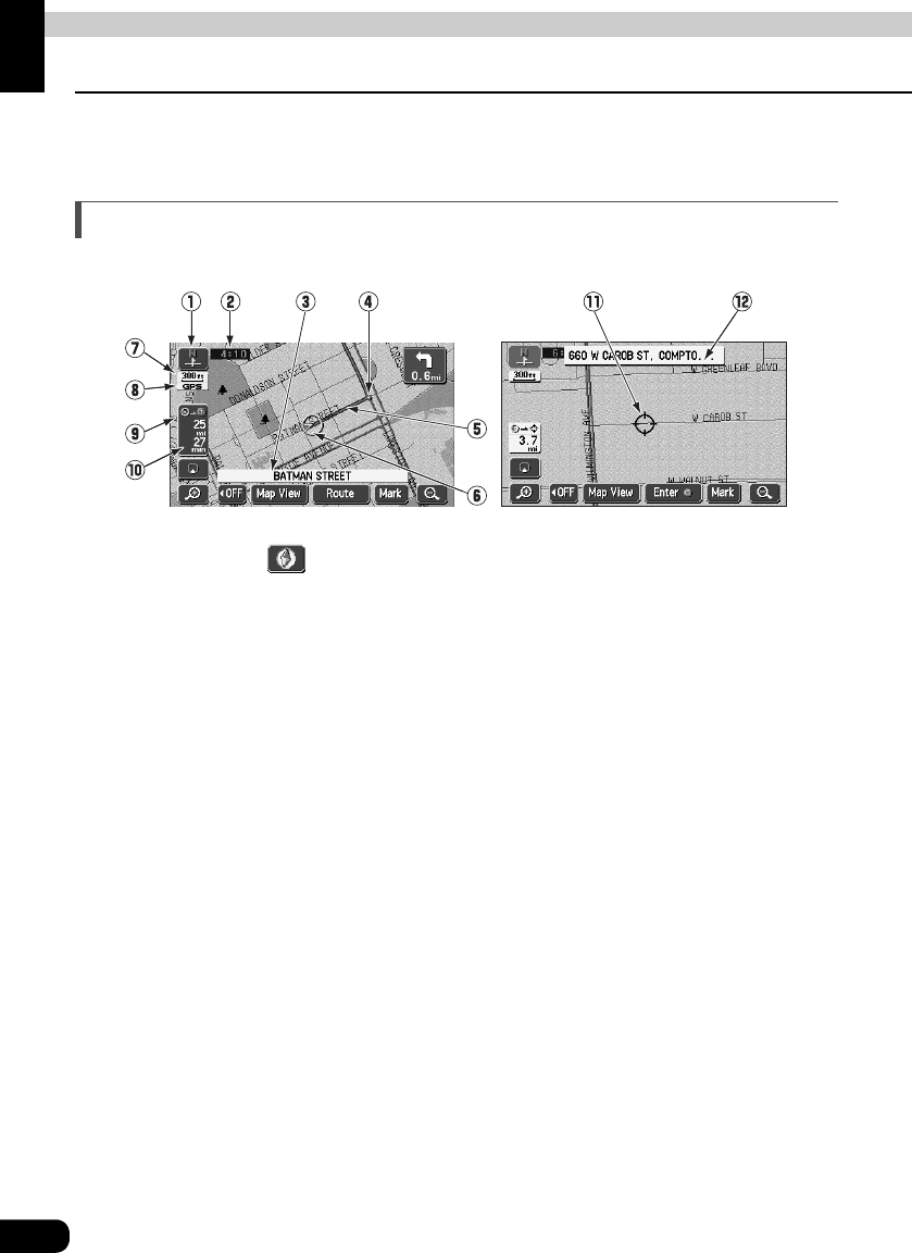
3. GPS navigation system
By setting your destination, the device will automatically perform a route search and guide
you through the route using screen displays and voice announcements.
How to view the navigation screen
The navigation map display consists of a present location screen and a scrolled map screen.
1 Orientation mark ( , when the bearing is pointing upwards) The map orientation is
indicated.
• Refer to "Switching the map orientation" on page 32 for how to switch the map direction
(North up or Heading up).
2 Clock display
The present time is indicated.
• See page 22 for information concerning this mark's display.
3 Name display
The following names appear depending on the situation.
(Only geographical points represented as data in the map disk)
• Names of junction and non-junction intersections
• Names of roads taken
• Names of interchange exits
4 Instruction points
Intersection guidance (intersection name display / intersection guidance screen) is
displayed.
• Refer to "Intersection guidance" on page 84 for information concerning intersection
guidance.
5 Route display
When setting your destination, the route all the way to that point is displayed.
• Route guidance will occur only when the present location appears on a dark blue line.
Scroll map screenPresent location screen