Line 2: The city where the airport is located.
Line 3: The state if the airport is located in the U.S., the Province if locat-
ed in Canada, or the country if outside the U.S. and Canada. A listing of
the abbreviations used for States, Provinces, and countries is contained in
Appendix D. The right side of line 3 displays HELIPORT, MILITARY, or
PRIVATE as appropriate.
Line 4: The magnetic bearing to or the magnetic radial from the airport
and the distance. Placing the cursor over the radial/bearing field and turn-
ing the right inner knob changes between radial from and bearing to the
airport.
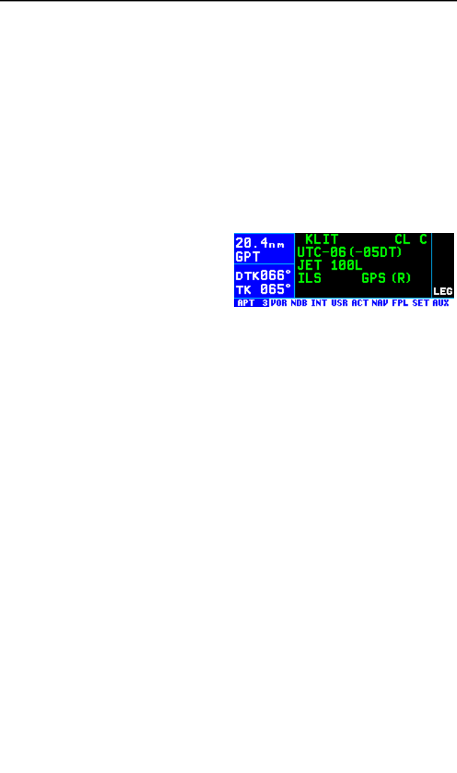
3.12.1.3. The Airport 3 (APT 3) Page
See figure 3-151.
Line 1: The ICAO identifier (see
section 2.3) of the airport; an arrow
precedes the identifier if it is the
active waypoint. Also on line 1 is the
environment. For example, the air-
port in figure 3-151 has overlying Class C airspace. The possible
environments are:
CL B Class B airspace
CL C Class C airspace
CTA Control area
TMA Terminal area
TRSA Terminal radar service area
Line 2: The airport’s time difference from UTC during standard time and
during daylight time (in parentheses).
Line 3: Fuel types available at the airport. This line will be blank if there
is no fuel available at the airport.
80 80 octane
100 100 octane
100L 100 octane, low-lead
JET Jet fuel (of any type)
AUTO Automotive fuel (also known as MOGAS)
Line 4: Approach type(s) available at the airport. If an airport has an ILS
approach and/or an MLS approach, no indication of non-precision
approach availability will be given.
NO APR No IFR approach
NP APR Non-precision approach(es) only
ILS ILS approach
KLN 94 Pilot’s Guide Chapter 3 Basic GPS Operation
3-53
Figure 3-151